

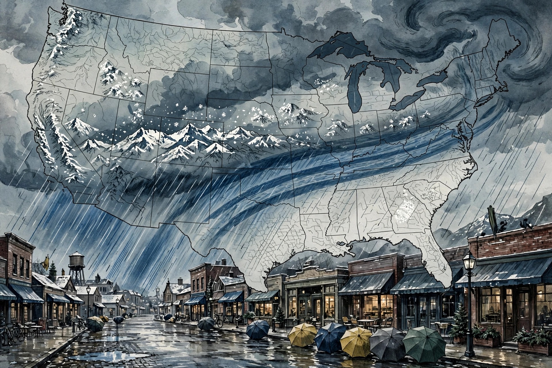
A powerful storm system is about to turn Halloween weekend into a washout for millions of Americans — and it will not stop there. Forecasters warned on Thursday, 29 October 2026, that a cross-country storm fuelled by a strong Pacific jet stream and an El Niño pattern is set to deliver dangerous weather to as many as 35 states over the coming week, beginning with heavy rain in California and the Southwest over Halloween weekend, continuing with snow in the mountains, flooding in the Plains and Midwest, and severe storms across the South and East into election week. For families planning trick-or-treating, outdoor parties and travel, the timing could hardly be worse. For emergency managers in places already saturated by a wet October, the forecast carries a more serious warning: in some areas, the ground cannot absorb much more water, and even a few extra inches of rain could turn streets into streams and dry washes into torrents.
The storm begins in the Pacific. Forecasters describe a strong upper-level low sitting near the Pacific Northwest coast on Friday, which will pivot a well-defined and powerful Pacific jet stream toward the Southwest. That jet will draw rich Pacific moisture inland, allowing a secondary low-pressure system to develop and pulling a plume of tropical and subtropical moisture across California, Arizona and New Mexico through the weekend. This is the classic set-up for a prolonged soaking in the Southwest: not a single fast-moving band of showers, but a sustained feed of moisture that can keep rain falling for days. Some rain was expected to fall in Arizona ahead of the main event, priming the ground, with the heavier rain arriving later on Saturday and into Sunday. By Monday morning, the system was forecast to push inland across the Southwest, spreading rain eastward and setting the stage for the next phase of the storm over the Plains and Midwest.
California and the Southwest take the first hit
Southern California faces the most immediate disruption. Moderate-to-heavy soaking rains were forecast to arrive by Saturday, likely disrupting Halloween plans in the state’s largest cities, including Los Angeles and San Diego. Rain on Halloween is rare enough in San Diego to be a curiosity in its own right: the city has recorded measurable rain on only nine Halloweens since records began in 1850, with the most recent rainy Halloween in 1987. This year looks set to add a tenth. The rain will not be confined to the coast. Across Arizona, widespread totals of one to two inches or more were forecast through Monday, with as much as five inches possible from Phoenix to Flagstaff. That matters because Flagstaff has already recorded 5.69 inches of rain so far in October; forecasters warned that three additional inches could trigger significant flash flooding in and around the city. A level two out of four flash flood threat was in effect across the region through the whole weekend, meaning flash flooding is possible and residents in flood-prone areas should stay alert, even if the rain at any given moment looks unremarkable.
The Southwest’s vulnerability to this kind of storm is not only about how much rain falls, but about where it falls and how fast the landscape responds. In desert and mountain terrain, rain that would soak harmlessly into soft soil elsewhere can run off baked or rocky ground in minutes, funnelling into washes, canyons and underpasses that are dry for most of the year. Burn scars from recent wildfires are especially dangerous, because scorched soil repels water rather than absorbing it, sending mud and debris downhill with little warning. Drivers face a particular risk: it takes only a small depth of fast-moving water to sweep a vehicle away, and flooded desert roads can be deceptively deep where the pavement dips. Forecasters and local officials repeat the same advice every time this pattern appears — never drive through flooded roadways, never walk through moving water, and never assume a familiar road is safe simply because it was dry an hour earlier — because the deaths in flash floods so often involve someone who underestimated a crossing that looked passable.
Higher elevations will see the same storm in a different form. The southern Rockies were forecast to receive the highest snow totals, between 12 and 18 inches, with snow also possible in parts of the Sierra Nevada. For ski areas and mountain communities, early-season snow of that depth is welcome in one sense, building a base before winter, but it arrives with gusty winds, poor visibility and hazardous driving conditions on mountain passes that are still carrying autumn traffic. Travellers heading over the Rockies over Halloween weekend were advised to check road conditions before setting out, to carry emergency supplies, and to be prepared for sudden closures if snowfall rates exceed ploughing capacity. The contrast within a single storm system — rain flooding desert cities while snow piles up a few hundred miles away in the mountains — is a reminder of how much weather in the American West depends on elevation, and how a single forecast can mean entirely different hazards depending on which side of a mountain range a person happens to live.
Trick-or-treating in the rain
For children and parents, the most immediate question is simpler: what will Halloween night itself look like? The answer, according to the forecasts published in the days before the storm, depends heavily on location. AccuWeather’s trick-or-treat outlook warned that showers and thunderstorms could soak Halloween plans across Texas, the Plains and much of the West on Friday, 30 October, and Saturday, 31 October, while most of the East looked dry. The Plains were identified as the main trouble spot, as moisture from the Gulf and the tropics built over Texas. Rain could be heavy enough to wash out outdoor events on Friday and Friday night from South Texas to western and central Kansas, and repeated downpours from Thursday through Halloween could lead to flash flooding in the same corridor. Thunderstorms were expected to rumble through communities from South Texas to southern Louisiana, including San Antonio and Houston in Texas and New Orleans in Louisiana. Farther west, spotty showers were expected over the Rockies, with some rain reaching Los Angeles and San Diego by Halloween itself.
Earlier in the week, the National Weather Service had already flagged three states for potentially rough storms on Halloween night: Minnesota, Missouri and Arizona. Its early trick-or-treat guidance noted that while most of the East and South would be warm and dry, Minneapolis, Kansas City and even Phoenix could be dodging showers, and the Pacific Northwest could be on the chillier side. The Weather Channel’s trick-or-treat forecast offered a broadly similar picture, with Southern California and much of the Southwest wet on Saturday evening, snow possible in parts of the Rockies and the Sierra Nevada, a chance of showers and storms on Saturday evening anywhere from Arkansas and Louisiana to the Carolinas, and a few showers and gusty winds in South Florida. For much of the East, the news was better: high pressure was expected to keep the Northeast dry with light winds, and AccuWeather expected the most comfortable conditions from northern Florida to New England and the Great Lakes, with temperatures running several degrees above normal. The Midwest was expected to be mild too, with evening temperatures in the 50s and 60s, though a few showers could appear in the Mississippi and Ohio valleys.
The coldest Halloween conditions were forecast for the northern Rockies and Pacific Northwest, where Montana, Idaho, Wyoming and eastern Washington and Oregon could see RealFeel temperatures in the 30s and 40s — a sharp contrast with the mild East, and a reminder to dress children in warm layers beneath costumes rather than relying on a thin outfit alone. Halloween night is also the last evening of daylight saving time this year, with clocks falling back early on Sunday, 1 November, the earliest possible date for the change. Forecasters noted that sunset would arrive before 5 p.m. that day in cities including New York, Chicago, Denver, Los Angeles and Seattle, which means trick-or-treating on Saturday evening and travel on Sunday will both take place in earlier darkness than many people expect. For parents, the practical advice from forecasters was consistent: check the local forecast on the day rather than relying on a national outlook, build in a rain plan for outdoor events, and treat any forecast of thunderstorms as a reason to move celebrations indoors rather than waiting to see whether lightning stays away.
The storm does not stop at the weekend
What makes this system unusual is not only its Halloween timing but its sheer reach and duration. After soaking the Southwest, the storm was forecast to move into the Plains and Midwest from Monday onwards. Heavy rain there could increase the risk of flash flooding across the Plains, and nearly 40 million Americans were placed under a broad level one out of four flash flood threat stretching from Texas to Wisconsin on Monday. A level one threat is the lowest on the scale, but across such a large population it still means millions of people living near rivers, creeks and low-lying roads need to watch water levels closely, particularly where soils are already saturated. As the system progresses, a new area of low pressure was expected to form across the Plains, allowing warm, moist air to stream northward and interact with an approaching cold front. That interaction is the classic recipe for severe thunderstorms, and forecasters warned that severe storms could develop along the front from Tuesday into Wednesday, from Texas into parts of the Southeast.
From Wednesday onwards, the storms were forecast to continue moving east, potentially bringing heavy rain on Thursday and Friday to major cities along the Interstate 95 corridor. That eastward march means the same storm that soaks Halloween in California could be drenching the East Coast almost a week later, having crossed the entire continent in stages. It also means the storm will still be active on election day, Tuesday, 3 November, when voters head to the polls in midterm elections. Heavy rain, flooding or severe weather on election day does not stop voting, but it can slow travel to polling places, disrupt outdoor campaign events and complicate the work of election officials, particularly in rural areas where a flooded road can be the only route to a polling station. Voters in affected areas were advised to check local conditions, allow extra travel time and, where their state offers it, consider early voting options before the worst weather arrives.
Forecasters were careful to stress the uncertainty in the later stages of the forecast. Models disagreed about exactly where the Plains low-pressure system would form and how strong it would become, which in turn affects where the heaviest rain and the most severe storms will develop. That uncertainty is normal several days ahead of a complex, multi-stage storm, but it has a practical consequence: the specific towns and counties at greatest risk on Tuesday and Wednesday may shift as newer forecasts arrive, and residents should follow updated local forecasts rather than treating the first outlook as final. The broad pattern, however, was consistent across the major forecast centres: a wet Southwest weekend, a snowy Rockies interlude, a rainy and potentially stormy Plains and Midwest early in the week, and a wet East Coast finish. The details will change; the cross-country journey of the storm will not.
How to stay safe as the storm crosses the country
The safety guidance for a storm of this scale is mostly familiar, but it bears repeating because the hazards change as the storm moves. In the Southwest this weekend, the main dangers are flash flooding and driving through flooded roads, especially in desert washes, canyons and urban underpasses that fill quickly. In the mountains, the dangers are heavy snow, low visibility and icy or closed passes. In the Plains and Midwest early next week, the dangers broaden to include river flooding, which can develop more slowly but last longer, and severe thunderstorms, which can bring damaging winds, large hail and tornadoes with little warning. In the East later in the week, heavy rain on already wet ground raises the risk of urban flooding and swollen streams. In every region, the single most important step is the same: know the forecast for your specific location, have more than one way to receive weather warnings, and do not wait until water is visibly rising to act.
Households can take a few practical steps before the storm arrives. Clearing drains and gutters helps water flow away from homes rather than pooling against foundations. Moving valuables, vehicles and outdoor equipment to higher ground costs little and can prevent the most common flood losses. Charging phones and keeping a battery-powered radio or weather radio available ensures warnings still arrive if power fails. For Halloween specifically, organisers of outdoor events in the Southwest, Texas and the Plains were advised to have an indoor backup venue, to postpone rather than gamble on a gap between storms, and to avoid setting up tents, inflatables or electrical displays in areas that could flood or be struck by lightning. Drivers planning cross-country travel over the coming week should build in extra time, check state road condition websites before departure, and be ready to delay a leg of the journey if a pass closes or a highway floods. A storm that spans 35 states will not be avoided by driving around it; the safer strategy is to wait it out where shelter is available.
By the end of next week, forecasters expect the storm to have delivered something to almost every region of the country except the driest parts of the East: rain to the Southwest and the Plains, snow to the Rockies, storms to the South and rain to the East Coast. That breadth is what earned it the label of a cross-country storm, and it is why a single weather system is dominating forecasts from San Diego to the Carolinas at the same time. Halloween will be remembered this year, in much of the West and the Plains, as the wet one — the year San Diego may have recorded its tenth rainy Halloween since 1850, the year Flagstaff watched its October rainfall climb toward nine inches, and the year trick-or-treaters traded costumes for ponchos. But the storm’s longer legacy may be the flooding and disruption it leaves behind as it marches east, a reminder that in a country as large as the United States, one storm can be a local inconvenience in one state, a serious flood threat in the next, and a snow emergency in a third, all at the same time.
Sources
USN reviewed reporting from multiple outlets for this story. Read more from Fox Weather, 107.9 KBPI and The Spun.
[…] days before Thanksgiving and Christmas, adding predictable peaks to an already elevated baseline. A storm spanning 35 states was also threatening Halloween weekend travel and plans across the country, a reminder that San Francisco’s preparations were unfolding inside a much wider unsettled […]
[…] not by the separate Halloween storm system that has been covered elsewhere. Readers following this week’s coastal storms should note that distinction: king tides, not the Halloween storm, explain the Huntington Beach […]