

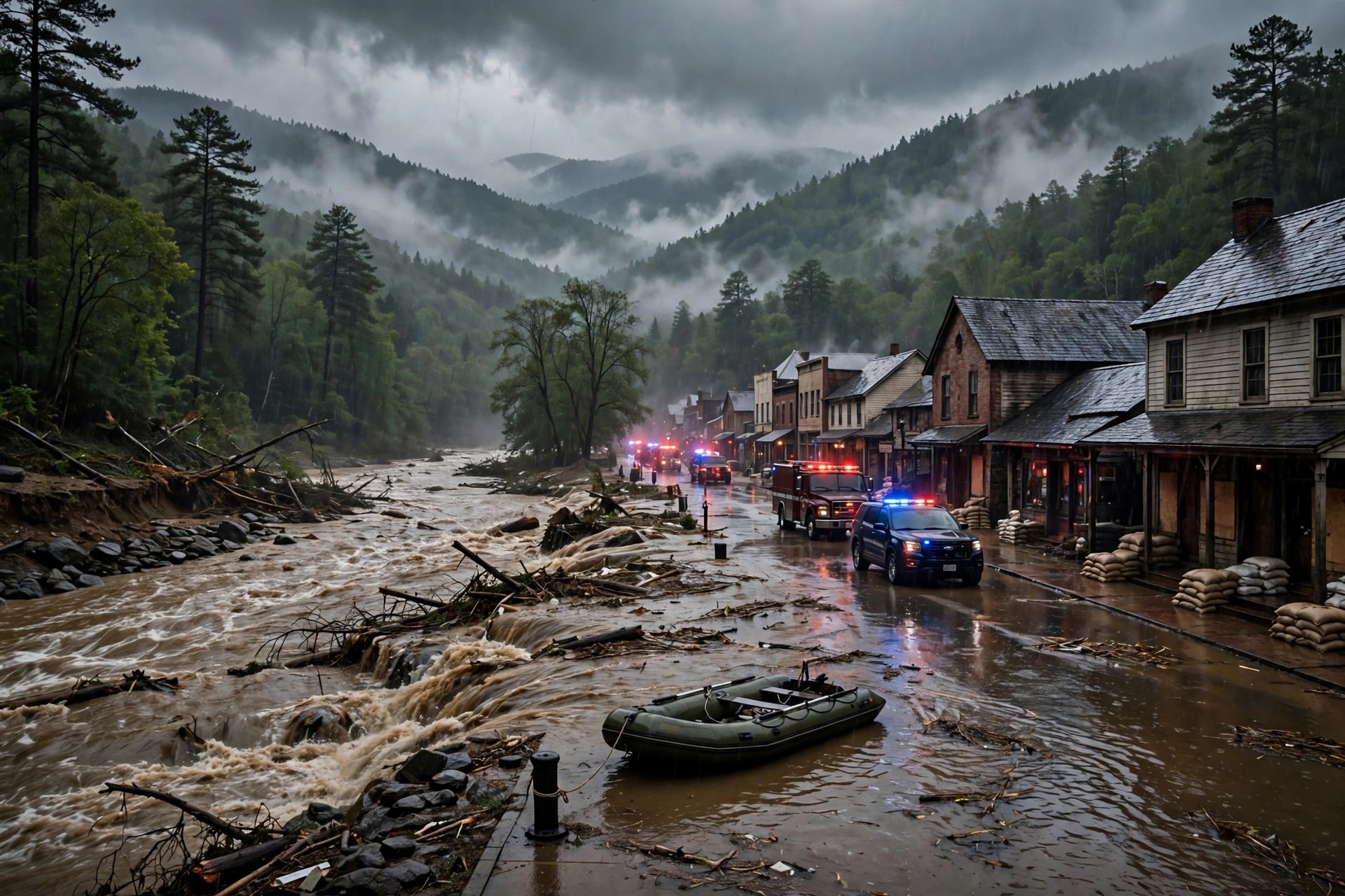
Catastrophic flash flooding struck north Georgia overnight Wednesday into Thursday, 5 November 2026, turning streets into fast-moving water in McCaysville and forcing emergency crews into one of the most demanding rescue operations the small border town has faced in living memory. More than 30 water rescues were carried out in McCaysville, a Fannin County town of about 1,000 people on the Georgia–Tennessee border, as thunderstorms dropped heavy rain across the region and the Toccoa River rose to a record crest. By late Thursday morning, no injuries or deaths had been reported, a fact that stood out against the scale of the flooding, even as some residents remained stranded in places crews could not safely reach.
The flooding arrived quickly, in the way flash flooding often does in mountain valleys, where steep ground and narrow river channels leave little time between heavy rain and rising water. Thunderstorms dropped 3 to 5 inches of rain in McCaysville itself, while 8 to 10 inches fell between Blue Ridge and Ellijay, to the south and east of the town. That rain had to go somewhere, and in this part of north Georgia it drains toward the Toccoa River, which flows through McCaysville and across the state line into Tennessee. As the water gathered from hillsides, creeks and tributaries, the river rose steadily through the night and into Thursday, eventually reaching a crest of just over 18 feet at Copperhill, Tennessee, just across the border from McCaysville.
That crest was a record. The previous record at Copperhill was 17.8 feet, set on 16 February 1990, and the river on Thursday passed it. The difference between the two figures may sound small in feet and inches, but in a river town it is not a small matter at all. A few inches of additional river height can mean the difference between water staying in its channel and water spreading across roads, yards, homes and businesses. It can mean the difference between a road that is passable and a road that is not, between a home that stays dry and a home that takes on water. For residents who had lived through earlier floods, the sight of the river passing a mark set more than three decades earlier was a measure of how serious this event had become.
North Georgia Flooding in McCaysville: How the Water Rose Overnight
McCaysville sits in a landscape that makes it vulnerable to exactly this kind of event. It is a small town, home to about 1,000 people, set on the Georgia–Tennessee border in the mountains of Fannin County. The Toccoa River runs through the area, and the town’s closeness to the river is part of its character and its history. That closeness also means that when the river rises, the town feels it at once. The overnight timing added to the difficulty. Flooding that develops while people are asleep, or while it is still dark, is harder to see coming and harder to move through safely. Roads that look familiar in daylight can be unrecognisable under water, and the depth and speed of floodwater are difficult to judge in the dark.
The rain totals help to explain why the flooding was so severe. Three to 5 inches of rain in McCaysville alone would be a heavy fall by any measure, and it fell in a short period during thunderstorms rather than spread over days. The larger totals of 8 to 10 inches between Blue Ridge and Ellijay show how much water was falling across the wider catchment that feeds the river. Rain falling on ground that is already wet, or falling faster than the ground can absorb it, runs off into streams and rivers, and in steep country that runoff arrives quickly. By the time the river at Copperhill reached its record crest, the water had already been rising through the town for hours, cutting off routes and surrounding buildings.
Flash flooding is often described in terms of rainfall and river levels, but for the people living through it, the experience is measured in more immediate terms: water at the door, water in the street, a car that will not move, a road that has disappeared under a brown, fast-moving current. It is the kind of flooding that does not wait for daylight or for a convenient moment. Emergency crews working through the night faced those conditions directly, moving through water whose depth and strength could change from one street to the next.
Toccoa River Record Crest Above 18 Feet at Copperhill
The river gauge at Copperhill, Tennessee, gave the flooding its clearest single number. A crest of just over 18 feet passed the previous record of 17.8 feet, set on 16 February 1990. River crests are measured at a fixed point, and they provide a way to compare one flood with another over many years. The 1990 mark had stood for more than 36 years, through many other storms and many other high-water events. Passing it put the November 2026 flood into a category of its own in the local record.
Copperhill lies just across the state line from McCaysville, and the two communities are closely linked. The river does not observe a state boundary, and flooding on one side of the line is felt on the other. A record crest at Copperhill therefore describes conditions in McCaysville as well, where the same river was rising through the same valley. For residents and for emergency managers, the record was not only a statistic. It was a sign that the water was higher than it had been in any flood since at least 1990, and that the response would need to match that scale.
Record river levels also carry a warning about what can happen downstream. Water that crests at one point continues to move, and communities further along the river can face rising water even after the rain has stopped. In this case, the immediate concern on Thursday was for the people in and around McCaysville itself, where rescues were under way and where some residents remained stranded. The record crest gave that concern a precise form: this was not a routine high-water event, but one that had passed every mark set in the modern record.
More Than 30 Water Rescues in McCaysville
The most urgent work of the night and the morning was the rescue effort. More than 30 water rescues were carried out in McCaysville, a large number for a town of about 1,000 people. Each rescue represents a person, or a household, that could not get out safely on its own and needed trained crews to reach them through floodwater. Water rescues are among the most difficult and dangerous tasks emergency responders undertake. Floodwater can be cold, fast and full of debris, and it can hide hazards beneath the surface, from submerged vehicles to open manholes to broken ground. Crews must judge, again and again, whether they can reach a person safely, and how to bring that person out without putting more lives at risk.
By late Thursday morning, no injuries or deaths had been reported. That outcome, if it holds, would be a significant one, given the number of rescues and the scale of the flooding. It reflects, in part, the work of the crews who carried out those rescues through the night and into the morning, and in part the decisions of residents who sought higher ground or shelter when the water began to rise. It also reflects the limits of what was known by late Thursday morning. In a flooding event that is still under way, information changes as crews reach new areas and as the water recedes, and the picture on Thursday morning was not yet complete.
Some residents remained stranded where crews could not safely reach them. That detail, reported by late Thursday morning, underlines how difficult the conditions remained even after dozens of rescues had been completed. Stranded does not necessarily mean injured, and it does not necessarily mean in immediate danger, but it does mean cut off, waiting for water to fall or for a safe route to open. For those residents, and for their families elsewhere, the hours of waiting would have been among the hardest parts of the event. For the crews, the stranded residents represented work that could not yet be finished, and a reason to keep watching the river and the roads.
State of Emergency, Shelters and Closed Roads
McCaysville declared a state of emergency as the flooding developed, and closed the city to unauthorised personnel. A state of emergency declaration is a formal step that gives local officials additional authority to direct the response, to restrict access to dangerous areas, and to bring in help from outside the town. Closing the city to unauthorised personnel serves a practical purpose as well. Flooded streets draw onlookers, and onlookers can become victims, or can block the roads that rescue vehicles need. Keeping unauthorised people out allows crews to work without the added risk of traffic moving through water, and reduces the chance that someone unfamiliar with the conditions will drive into a flooded stretch of road.
Shelters were opened at the Fannin County Recreation Center, giving residents who had to leave their homes a place to go. A shelter in a flooding event is more than a roof. It is a dry place, a warm place, and a place where people can wait for news about their homes and their streets. For families who left in the night, with little more than what they could carry, a shelter provides a first point of stability. It also gives emergency managers a place to account for people, to pass on information, and to direct help where it is needed. The opening of a shelter is a sign that officials expected a significant number of people to be displaced, at least for a time, and wanted them to have somewhere safe to wait.
The combination of an emergency declaration, a closure and an open shelter describes a town taking the flooding seriously and organising itself around the response. In a community of about 1,000 people, that organisation depends heavily on local officials, local emergency crews and neighbours. The scale of the rescue effort, more than 30 water rescues, shows how much was asked of those crews in a short period, and how quickly the flooding overwhelmed the ordinary routines of the town.
Georgia Flooding: Schools Closed in Fannin and Gilmer Counties
Fannin and Gilmer County schools cancelled classes on Thursday, a decision that followed directly from the flooding. School closures in a flooding event are not only about whether a school building itself is flooded. They are about whether buses can run safely, whether roads are passable, whether children can get to school and back without crossing floodwater, and whether staff can reach their workplaces. When roads are closed and water is still rising or still standing, keeping children at home is the safer course, and it also keeps school buses and family cars off roads that rescue crews need.
The closure across two counties, Fannin and Gilmer, shows that the flooding was not confined to a single street or a single town. Gilmer County, which includes Ellijay, was among the areas that received the heaviest rain, with 8 to 10 inches falling between Blue Ridge and Ellijay. That rain, and the flooding it caused, affected a wider area than McCaysville alone, even though McCaysville was where the rescues were concentrated and where the emergency declaration was made. School systems in both counties faced the same question on Thursday morning: whether it was safe to open, and the answer in both cases was no.
For families, a school closure on a flooding day is a disruption, but it is also a relief. Parents do not have to decide whether a route to school is safe, and children are not put on roads that may be under water. The closure also frees school buildings and staff, in some cases, to be used as part of a wider community response, although no such use was described in the reports available by late Thursday morning. What was clear was that the flooding had reached far enough into daily life to close schools across two counties, a measure of how widely the storm had been felt.
A Small Border Town Facing a Record Flood
McCaysville’s size shapes the way a flood like this is experienced. A town of about 1,000 people is a place where many residents know each other, where a flooded street is a street that neighbours use every day, and where a rescue is likely to involve someone the rescuers know. That closeness can be a strength in an emergency, as neighbours check on each other and share information, but it also means that the effects of the flooding are felt personally and widely. When more than 30 rescues are carried out in a town of that size, a large share of the community is directly affected, either as a person rescued, as a family member waiting for news, or as a neighbour watching water rise toward a familiar home.
The town’s position on the Georgia–Tennessee border also matters. McCaysville and Copperhill are twin communities on either side of the state line, and the river that separates them also joins them. Flooding in one is flooding in the other, and a record crest measured at Copperhill is a record for the whole valley. Emergency response in such a place often crosses the same line, with help coming from whichever side can reach the people who need it. The reports available by late Thursday morning did not detail which agencies took part in the rescues, but the scale of the operation, and the number of people brought out of the water, suggest a response that drew on more than a single crew.
The timing of the flood, overnight Wednesday into Thursday, meant that much of the worst of it happened while the town was dark and quiet. People woke to water, or were woken by it, and the first hours of the response took place before daylight. That is a common pattern in flash flooding, and it is one of the reasons the events are so dangerous. There is little time to prepare, and the water arrives before many people have had a chance to move vehicles, to gather belongings, or to leave. By Thursday morning, the town was dealing with the consequences of a night in which the river had risen past every mark set since 1990.
What Was Known by Late Thursday Morning
By late Thursday morning, the known facts formed a clear outline, even though much remained uncertain. More than 30 water rescues had been carried out in McCaysville. The Toccoa River had crested at just over 18 feet at Copperhill, passing the previous record of 17.8 feet from 16 February 1990. McCaysville had declared a state of emergency, closed the city to unauthorised personnel, and opened shelters at the Fannin County Recreation Center. Fannin and Gilmer County schools had cancelled classes for Thursday. No injuries or deaths had been reported, but some residents remained stranded where crews could not safely reach them.
What was not yet known was equally important. The full extent of damage to homes, businesses and roads had not been assessed. The number of people displaced, the number of homes that had taken on water, and the condition of roads and bridges across the affected area were still to be determined. The stranded residents still needed to be reached, and the river still needed to fall before a full picture could emerge. In flooding events, the first reports describe the rescue effort and the river levels. The fuller accounting, of damage and of recovery, comes later, once the water has receded and officials and residents can see what it left behind.
For now, the story of Thursday in McCaysville is a story of a record river, a night of heavy rain, and a rescue effort that brought more than 30 people out of floodwater in a town of about 1,000. It is also a story of a community that, by late Thursday morning, had suffered no reported loss of life, even as the water stood at a height not seen since 1990. That combination, a record flood and no reported deaths or injuries, is the central fact of the day, and the one that will shape how the town remembers this flood in the years to come.
Sources
USN reviewed reporting from multiple outlets for this story. Read more from Associated Press, Savannah Now and Atlanta News First.